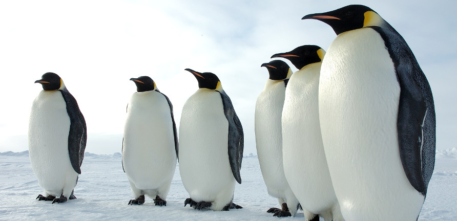
photo by Glen Grant, U.S. Antarctic Program, National Science Foundation
Help scientists learn about penguins and the Southern Ocean marine habitat by tagging images collected from environmental cameras in Antarctica. Scientists want to learn more about these these aquatic flightless birds, from how the eggs and baby chics are doing to what predetaors or other fauna may be hanging around the colony. The images come from several dozen cameras focussed on the nesting areas of penguin colonies around the Southern Ocean. Volunteers are asked to tag adult penguins, chicks, and eggs.
This project will lead to better understanding of penguins, how they over-winter, the timing of breeding, and the impact of predators. Antarctic penguin colonies reside in part of the world that is very difficult to study because of its rugged, cold conditions. Environmental cameras produce a deluge of images allowing unprecedented access to study this poorly understood area of the globe.
Project owners + coordinators:
Chris Lintott, Zooniverse lead
Rob Simpson, developer
The Penguin Watch Team
To learn more and participate, visit: https://www.penguinwatch.org/
To stay up-to-date on this project:
• follow twitter.com/penguin_watch
• read penguinlifelines.wordpress.com/
• join talk.penguinwatch.org/
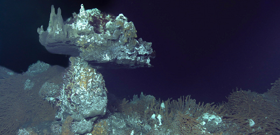
Help analyze deep-sea videos – 15 seconds at a time. NEPTUNE Canada invites you to participate in ocean science research (no experience required!). By playing Digital Fishers you’ll help researchers gather data from video, and unveil the mechanisms shaping the animal communities inhabiting the deep.
NEPTUNE Canada is an array of ocean observatories off the west coast of Vancouver Island, connected by an 812 km loop of fibre optic cable relaying data between hundreds of scientific instruments. The NEPTUNE Canada database, containing both live and archived data, can be freely explored by anyone with Internet access.
Input from Digital Fishers is helping organize and annotate thousands of hours of video from NEPTUNE undersea cameras, providing a rich resource for sea life researchers, and helping to catalogue the variety and abundance of sea life found on these rock structures.
Project owners + coordinators:
Jodie Walsh, research coordinator
To learn more and participate, visit: https://digitalfishers.net
To stay up-to-date on this project:
• follow twitter.com/digitalfishers
• connect with facebook.com/digitalfishers
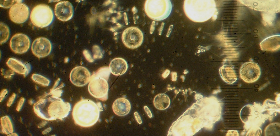
photo by willapalens
Classify different types of plankton to help analyze ocean health. Plankton are a critical source of food for life in the ocean – without plankton, we would have a lifeless ocean. Analyzing when and where plankton occur at different depths helps build a better understanding of the ocean from small to global scales. As a group, plankton are an eclectic collection of beautifully intricate organisms adrift in the oceanic waters. The classification of an organism as ‘plankton’ has nothing to do with its biological grouping, but rather with its inability to swim actively against oceanic currents. There are two main types of plankton: phytoplankton (plants) and zooplankton (animals).
Plankton Portal focuses primarily on zooplankton because the underwater camera system (named ISIIS, the In Situ Ichthyoplankton Imaging System) they use is optimized to photograph larger planktonic organisms. The weightlessness of life in the ocean environment allows for very delicate and complex body designs, which are almost impossible to keep intact with normal means of collection. Imaging systems provide a first glimpse of these amazing animals in their natural environment, and may even lead to discovery of new species.
Project owners + coordinators:
Bob Cowen, research director
Chris Lintott, Zooniverse lead
To learn more and participate, visit: https://planktonportal.org
To stay up-to-date on this project:
• follow twitter.com/planktonportal
• read blog.planktonportal.org
• join talk.planktonportal.org
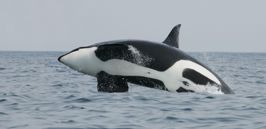
Help decode the language of whales. The Whale FM project ames to increase our understanding of what whales are saying to each other. Whales talk to each other in quite sophisticated ways. Each family of Killer Whales has its own dialect and closely-related families share calls, yet the communication of killer whales and pilot whales is still poorly understood. By listening to and categorizing whale calls, you can help demystify the complex language of these intelligent aquatic mammals.
The increasing size of current acoustic datasets and the large call repertoire make it very difficult for scientists to address these questions. A single person would take months to go through the data, and the outcome would still depend on a single persons’ interpretation.
By asking people to help categorize whale calls, Whale FM hopes to answer questions such as: How large is the call repertoire of pilot whales? Do the long and short finned pilot whales have different call repertoires? How well can the calls of vocal species such as pilot whales be categorized?
Project owners + coordinators:
Whale FM team, [email protected]
To learn more and participate, visit: https://whale.fm
To stay up-to-date on this project:
• follow twitter.com/whalefm
• read blog.whale.fm
• connect with facebook.com/pages/Whale-FM
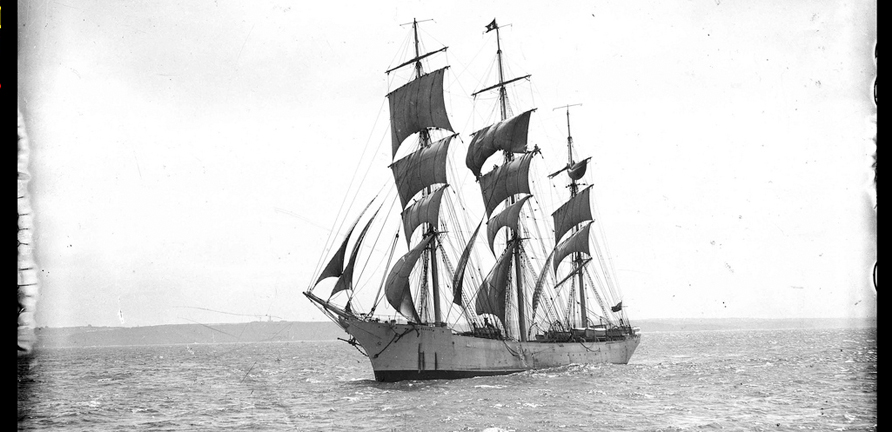
photo by William Hall
Help create weather models that forecast the future of Earth’s weather and climate. Logbooks detailing weather conditions were maintained by historic ships using pen and ink. Many of these logbooks have not been digitally transcribed and thus we have gaps in our knowledge and data about old weather patterns. This project asks for your help in transcribing these old logbooks into a digital format.
Oceans absorb and transport large amounts of heat and water around the world which affects our weather. Old Weather contains logbooks from the Arctic since the mid-19th century, Antarctic from the late 19th century/early 20th century, and from trading ships between the UK, India and China from the 1780’s to the 1830’s. By transcribing the location and weather conditions from hundreds or thousands of logbooks, people can feed that data into computer models, generating a 3D picture of weather around the globe. By understanding weather variability in the past, we can improve our understanding of what weather will do in the future.
Project owners + coordinators:
Chris Lintott, Zooniverse lead
Stuart Lynn, developer
The Old Weather Team
To learn more and participate, visit: https://oldweather.org
To stay up-to-date on this project:
• follow twitter.com/oldweather
• read blog.oldweather.org
• join forum.oldweather.org
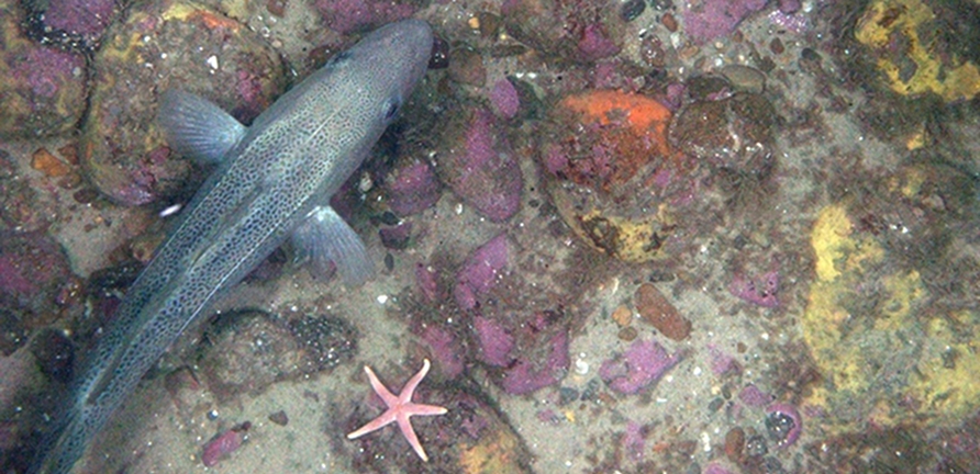
Comb the ocean floor with a treasure trove of seafloor imagery. The Seafloor Explorer project ames to create high-resolution maps of animal habitats, including how animals are distributed relative to their predators and how species distributions change over time. This can help with conservation efforts and better our understanding of ocean habitats.
The photos are collected by HabCam, an underwater mapping vehicle built by engineers and marine biologists from the Woods Hole Oceanographic Institution. Habcam takes millions of photos of the ocean floor along the northeast continental shelf. By revisting the area seasonally each year, Habcam provides the baseline of an exceptional and unique ecological time series. Seafloor Explorer needs contributers to help view the images and help identify species and ground cover.
Public contributors will view images and say whether they see fish, scallops and other organisms, provide basic measurements, and describe whether the seafloor is sand or gravel, and whether they see boulders and other interesting objects in the frame. Along the way, the contributors have a chance to enjoy working with seafloor imagery that has never been seen before, through a unique web interface.
Project owners + coordinators:
The Zooniverse Team, [email protected]
To learn more and participate, visit: https://seafloorexplorer.org
To stay up-to-date on this project:
• follow twitter.comseafloorexp
• connect with facebook.com/seafloorexplorer
• read blog.seafloorexplorer.org